Blogitty Blog Blog Blog

Showing the world I find (assuming I bring a camera and can eventually find Internet Access)

Wednesday, May 7, 2008

Campers Have S’more Fun

The last few postings have been back to back. If you didn’t realize this, you might be missing out on some of the pictures from the trip. Just FYI

-Jon

Got an early start and we split from Penbina River Provincial Park. (Probably closed) We seem to have this knack for finding campgrounds that are very popular during the height of the summer but are almost abandoned when we arrive in May. I’m pretty sure we were the only people camping in that campground last night.

It’s hard to explain how eerie it is when you are the only ones camping in a campground. Ryan and I kept our voices hushed. You could hear all these falling seed pods in the silence of the evening.

In spite of our spooky surroundings we managed to sleep an extra hour this morning before hitting the road.

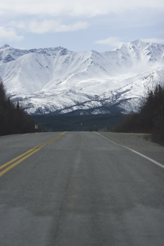
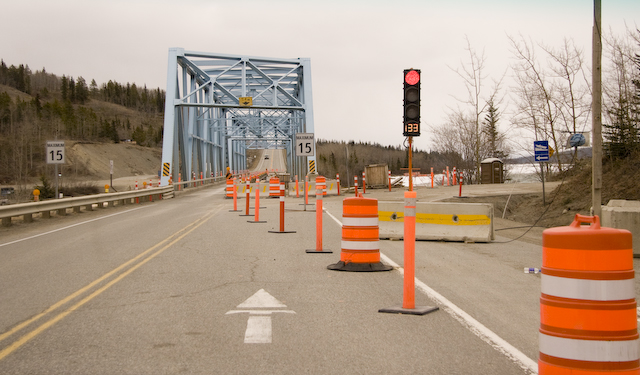
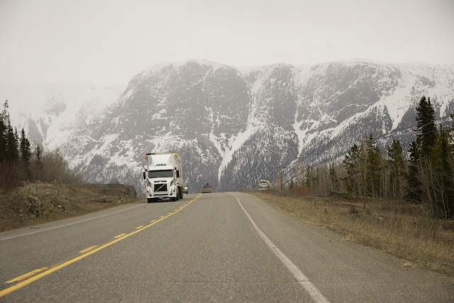
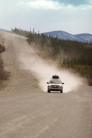
The trip has this flavor of drive drive drive, and occasionally stop for a picture if it’s near the gas station or lunch. So a lot of the pictures are shot from the car. I’ll roll down the window, lean way out and hope I don’t swallow a bug.

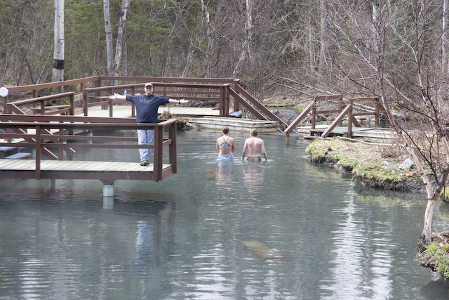
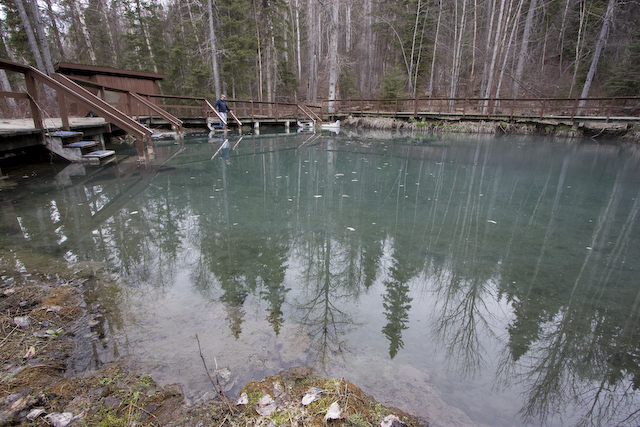
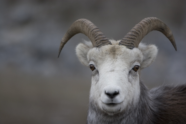
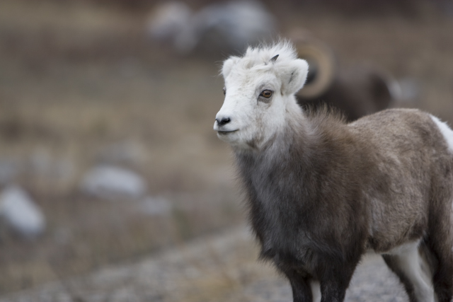
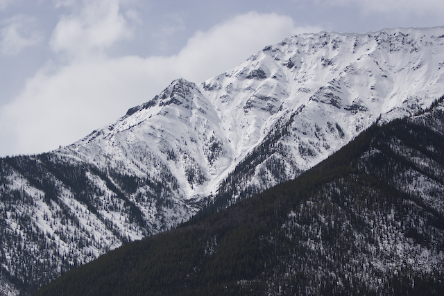
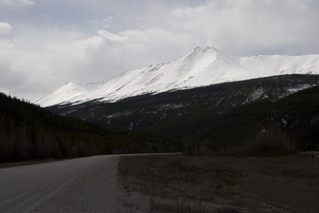
Having said that, the places we are stopping have some incredible picture opportunities. Check out some of my favorites from below.

I’ve also started to get a little home sick for America. It’s not the big differences that are getting to me. it’s these odd little things that keep coming up. I’m working on some photos to explain, I’ll post them later 🙂

We crossed into Montana at 6:30! Home is close(r) now. Well… Ryan says Montana is a big huge honkin state that will take days to cross. I’m skeptical. I mean days? Come on!

We’ve managed to find radio stations on the dial to listen to. Ryan’s been a good sport about the dead iPod. I think both of us were planning on it to provide the bulk of our entertainment. Dead iPod means that we’re improvising now. Since I have evdo coverage one of my thoughts is to use streaming Internet Radio sites like Pandora to keep us entertained.

Great Falls will be our camp for tonight. Yay for KOA! Odd as it sounds, Great Falls is the first place I’ve felt like I’m back in civilization. Not that I couldn’t find civilization didn’t exist in Canada (far from it) but now I have non roaming cell coverage and the evdo card is starting to work consistently. So I plan to soak up a little civilization, check the web, browse my e-mail, do a little yoga and do some laundry before we strike out into the wilderness, aiming for Colorado.

Pictures are below!

1

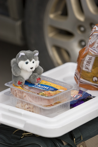
Lunch on the go. I bought a little Canadian Husky from the fuel store. He was their mascot. I figured I should bring back a souviner or two from the trip 🙂

2

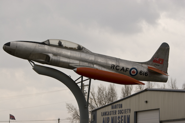
Planes on a stick. This was outside of the Hanton Lancaster Society Air Museum in Hanton, Alberta. Cool looking 🙂

3

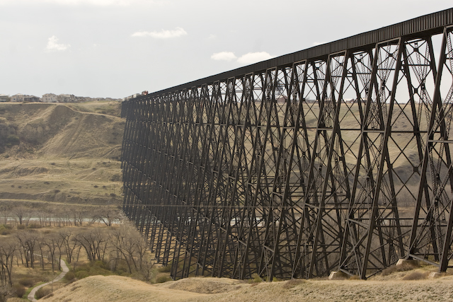
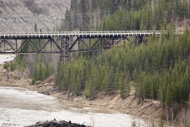
The worlds longest and tallest trestle. Just a hair over 1 mile long and around 1000 feet high. And there is a train on the other end. So Ryan and I race down to check it out as it goes over our heads. There were these piles of train metal that had fallen off of various train cars over the years. If something had fallen while we were down there it would have broken an arm or a head. Lucky for us, we stood off to the side outside of the falling debris zone. It was soo neat to watch it go over head 🙂

4

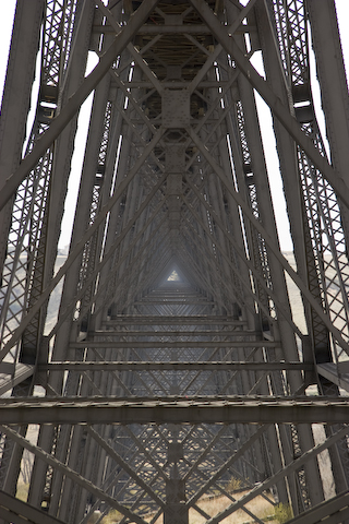
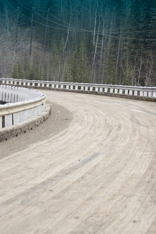
Me getting artsy on the bridge.

5

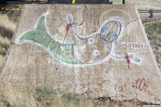
Graffiti on the bridge

6

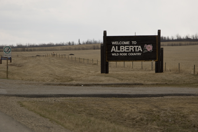
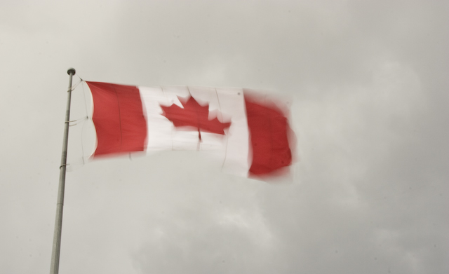
Welcome to Montana. Big sky country. No trees. 🙂

7

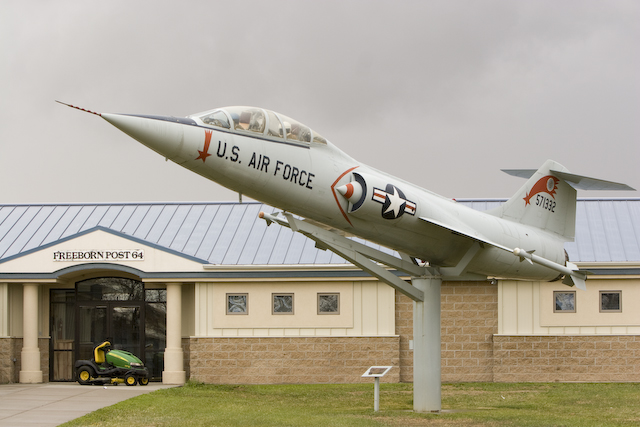
Jet on stick day I guess.

8

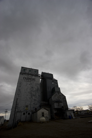
Spooky grain elevators we found along the way.

9

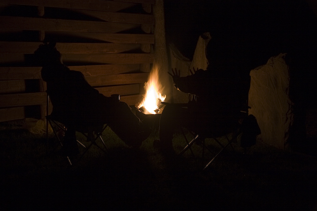
Portrait by the fire. Ryan’s on the left. I’m on the right. Go KOA 🙂

p.s. I swear, if I didn’t have my head screwed on. I just washed my chapstick and lens pen. The chapstick is ok. The Lens pen I’ll have to replace. It was almost time to do that anyways but couldn’t I have waited until I got home?

Oh well. No blood no foul right?

posted by Jon at 10:36 pm  

Wednesday, May 7, 2008

Sno Way, Eh?

After our bonus passport adventure yesterday we drove pretty late into the night. We found a little hotel at Pink Mountain, BC called Sasqwatch Crossing. There was a lot of Sasqwatch themed merchandise to buy in the store. We rented a couple rooms in the back and crashed for the night.

Well I didn’t go straight to bed, I spent some time blogging and getting the post(s) up yesterday. Then I got some sleep.

We set off early with the goal of getting into Jasper, Alberta for camp. We made really good time and the early start helped out quite a bit. On the last leg of the journey to Jasper we hit some rough spring weather. Mostly rain but there was a section where we found this slushy mix of hail and snow on the road for about a mile. The going became treacherous. We’re in a 4 wheel drive Subaru. he car is loaded with food and gear and not exactly balanced. This keeps the front of the car lighter. We were having some problems keeping the car going in the right direction. We got through the patch of road and made the call to not go through Jasper and Bamph. The road is high in the mountains and was getting the same kind of weather we just drove through. So rather than chance the car on a narrow winding road with some snow/ice/hail/rain/slush we’re going to Edmonton and then south to Calgary. Once we dropped in altitude the conditions improved. Now it’s just rain on the highway 🙂

We’ll miss out on the park but we will make it home. And that’s the important part.

On he other hand now there are a couple other national parks that we may visit on the return trip. And we will get back safely.

Did I mention that it was important that we get back safely?

🙂

We completed the AlCan highway. Made it into Dawsons Creek, BC today. 1500ish miles down… 1700 or so to go.

Even now we’re still surrounded by trees. Trees running off over the hills. Trees that start just past the clear cut zone on the side of the highway. Trees are everywhere. Most of them are Evergreen and Birch. A few others are just tucked in here and there. After a few days of just trees everywhere I’m looking forward to the open planes for a bit.

We’re moving out of the pretty part of Canada and into parts that look like Kansas and Colorado. So fewer landscape pictures today. I’ll have to get a little more creative with my pictures as we go on.

Enjoy today’s batch!

1

Turns out that originally all of the bridges on the Al-Can were wooden bridges.  Those were slowly replaced with metal and modern bridges.  This one still remains.  You have to duck out onto a stretch of the old highway to find it.

2

Even the bridge deck was wood.  We decided it was safe enough to drive across 🙂

3

Statue at the end/beginning of the AL-CAN highway.  I think he’s pointing the direction we were supposed to be going… not where we came from.  Too bad for him.

4

Ryan at the end of the AL-CAN.  The 3 indicates this is his third trip through here.  Not sure I want to be able to say that 😉

5

Me at the end of the Al-Can.  See how happy I am?  I haven’t yet learned that Colorado is more than a few hours away…
6

Into Alberta.  Woot!  One more province down!

7

Blurry shot of a caribou checking out the car as we drove bye.

8

Found this outside the Fuel store.  Looked so cool I wanted a picture.

9

Then I wanted one that shows the motion of the wind.  I like this one.  Ryan likes the other one better.  Just figured I would share them both 🙂

posted by Jon at 10:17 pm  

Tuesday, May 6, 2008

If you must shoes, shoes wisely.

Tight for time and internet access. So here is two days worth of information in one post. I’m not exactly sure when I will get to post next. We’re headed for Jasper and Bamph national parks. Could be a couple days. Anyways, here is where we left off 🙂

Leaving Kluane campground and the spectacular landscape we headed deeper into Yukon Territory and finally into British Columbia. Our destination was Laird Hot Springs. To get there we had to travel 500ish miles. Turns out it was mountainous and windy. The roughest part for both of us was the frost heaves. The ground under the road is permafrost and this wreaks havoc on the road. So you end up with sections of the road where pot holes appear or massive bumps and dips all stacked close together. So the road becomes treacherous to drive. The driver (not me) has to be constantly alert for these little orange flags on the side of the road. You then slow down or swerve around them. Since it’s early in the season there isn’t a lot of traffic to deal with on the road.

We have been taking advantage of the rally car inspired handling of the Subaru. 🙂

There were some really cool animals along side the road!

We arrive at Laird hot springs late that night. Set up camp and hustled over to the hot springs. They’re hot. And after spending a day or two cramped in a car… so very nice to get into.

The next day had us get up (32F) eat a hasty breakfast and hustle up to the hot springs. It made sense to visit a second time before leaving 😉

An hour south of of Laird I realized that my jacket was missing. it contained my iPod and Passport.

Oh crap.

We spend the next 2 hours retracing our stops and steps looking for the jacket. I walked ½ a mile along the road where we stopped to get some pictures of the mountains. We checked our fuel fill up stations. No luck. Last place to check was the hot springs. Turns out the park maintenance guy found my jacket and set it aside.

YAY!!!!

I left him $20 to go buy a beer… since I couldn’t stay and buy it for him. And I don’t drink… 🙂

It look like the jacket got run over once or twice. The jacket is fine. The passport is fine. The iPod is not… Everything looks ok on it but when you connect it to power you get this message with a dead iPod icon indicating you should check this website.

Pretty sure that’s a bad sign.

I can’t get the music off it either… so now we’re down to 6 mix cds. 🙁

Still… I was relieved to get the passport back and if I had to chose between the two… it’s still the passport.

I’m now storing the passport in a secure location 😉

We unfortunately blew our entire schedule for the day. The drive from Laird, to Laird and then away again ate up most of the day. We’re looking to camp at a town north of Ft. St. John. We’ll see how it turns out.

Below are pictures from both day’s travels. Enjoy!

Jon

1

The view from the campground. Seriously.

2

See! Nature trail from our campground!

http://zoron.org/posted/05042008/003.jpg

A gaming store in Whitehorse? We’ve so got to go. I bought some dice 🙂

4

It used to shuttle people up and down the river. In the Yukon Territory. Cool!

5

The construction traffic management here is automated. When the counter gets to 0 we get to go and the other side is stopped and clear.

6

The road is still pretty

7

8

Canada is on the Metric system. So to find these historic Mile markers along the Alaska Canada highway is kinda fun 🙂

9

My first Arctic Redfox!

10

At the sign post forest.

11

Me pointing to my town. Didn’t realize that Arvada sent up a sign 🙂 2347 miles is a long way to go.

12

Made it into British Columbia today!

13

14

Canadians have a different spelling for certain items. Especially in French 😉

1

Laird Hot springs. The lower pool

2

The water is very hot. But very nice for you. Here’s Ryan for scale 🙂

3

The upper pool at Laird Hot Springs. It’s hot! And deep. You have to tread water in the middle.

4

Mountain Sheep

5

Teenager Mountain Sheep. Note the rebellious hair.

6

Still very pretty on the drive

7

It stopped looking like this when we got out of the main mountains. Now, just rolling hills and endless forest.

posted by Jon at 12:55 am  
« Previous PageNext Page »

Powered by WordPress